|
Every mountain range has a unique vibe. In the US, the Sierra Mountains have my heart. In Europe, it's the Dolomites.
There is a unique activity to explore here, a step beyond traditional hiking. Maybe you'd like to do something more adventurous, but you're not quite ready for the gear requirements and learning curve of rock climbing. Well, as often happens in history, one person's misery becomes another's boon. There are heaps of metal cables strewn throughout this mountain range that were laid back when the Italians and Austro-Hungarians met in high altitude battle. Today, you can take a small amount of gear and use those cables to traverse routes that would be way too dangerous without the saftely of being hooked in. This is via ferrata (The "iron way") Have you tried this? What's your favorite route?
1 Comment
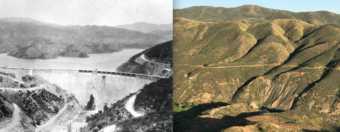
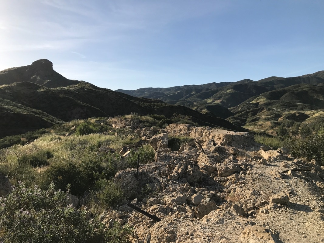
St. Francis Dam 1927 and its remains 93 years later
One night 500 Californians were killed and thrown into the ocean. There were smashed and drowned by a fifty meter wall of water as it tumbled violently down a series of valleys. Bodies were recovered as far south as Mexico. The catastrophic collapse of the St. Francis Dam was the second biggest tragedy in state history, and the epic downfall of California's favorite son: William Mulholland. Despite the dramatic story and stunning setting this spot is rarely visited. Southern California's grand disaster has become a traveler's secret spot. Here are my recommendations if you'd like to discover it: 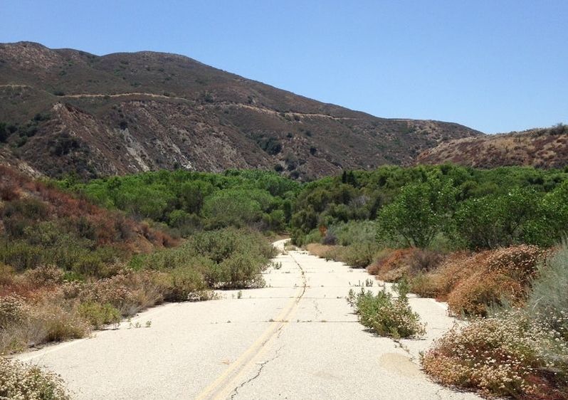
1. Hike Up the Abandoned Road: Take San Francisquito Canyon Road about a hundred meters north of San Francisquito Motorway. On the east side of the street you'll see this abandoned road barricaded off. Walk towards the lush forest growing where the old lake water pushed against the dam. Emerging from the forest there will be piles of rubble to your left and a small hill to your right. These are both worth exploring.
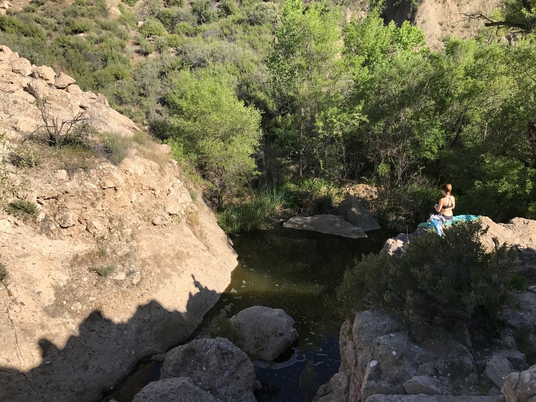
2. Scramble over the Rubble to the Left: Climbing over big chunks of the old dam notice metal pipes and other curiosities poking out of the ruins. Once you surmount the first pile you'll find a serene little creek and pool on the other side. It's a good spot for a tiny picnic. I took a dip on my first visit, but saw an unidentified snake slither off in the deep. There may also be more concrete with metal attachments underwater, so I'd advice against leaping in unless you thoroughly explore the depth.
3. Climb up the Ridge to the Right: After scrambling around the rubble to the left of the road, go back and scale that ridge on the other side. It has very clear remains of the dike which was a 3 meter extension of the old dam. From the top it's easy to see the exact placement of the doomed structure. Also, looking north, you get this gorgeous view of the forest, dramatically lush in contrast to the dry hills around. Notice your parked car off in the distance by the new road.
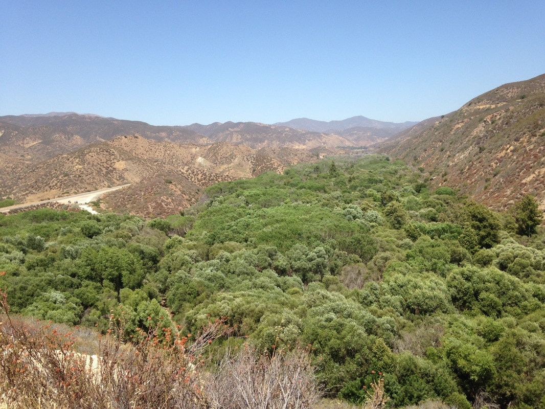
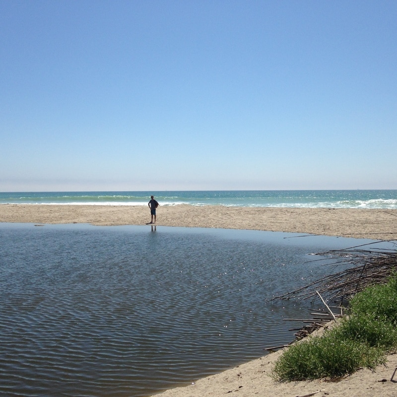
4. Head for the Big Rock in the Distance: From the ridge, looking across the rubble of the old dam, a prominent rock is visible. To get there drive down San Francisquito Motorway about 1.3 miles until a fireroad appears on the left. From there it's a fairly easy climb up to a T junction. Go left on the narrower trail which will lead straight to that rock. From the top one can see the remains of the entire old dam and trace the path of the water as it plowed down the valley before hooking a right around Castaic Junction, following the Santa Clara River Valley to the Pacific Ocean.
5. Extend your Exploration: To make a full day of the St. Francis Dam story, follow the water course down towards Ventura.
Before going, read the dramatic story of the St. Francis Dam and the rise and fall of Mulholland. It's a doozy of a tale which will make this adventure all the more impactful.
I can't definitively say the gear I have is the best on the market, but it's served me well. I scrolled through my purchase history on Amazon to find some of the items. I choose bright colors when I can because it's easier to spot in a hotel room (so you don't leave it behind), easier to keep an eye on while you take a swim at the beach, and thieves are less likely to grab something that is easy to follow.
There is a Road Less Traveled style adventure cutting right through the urban landscape of Yangon, Myanmar. With a decent sense of balance and comfort with risk, a unique walk leads from the center of the city to its edges. The entire sojourn occurs along a steel water pipe, commissioned by the colonial British, that runs over 50km to a reservoir. The location was shared with me by Blue Temple who are involved in inspiring community enhancement projects around the pipe. Check out what they've done. A few things to keep in mind:
On the maps below you'll see where to start and an ideal place to end. 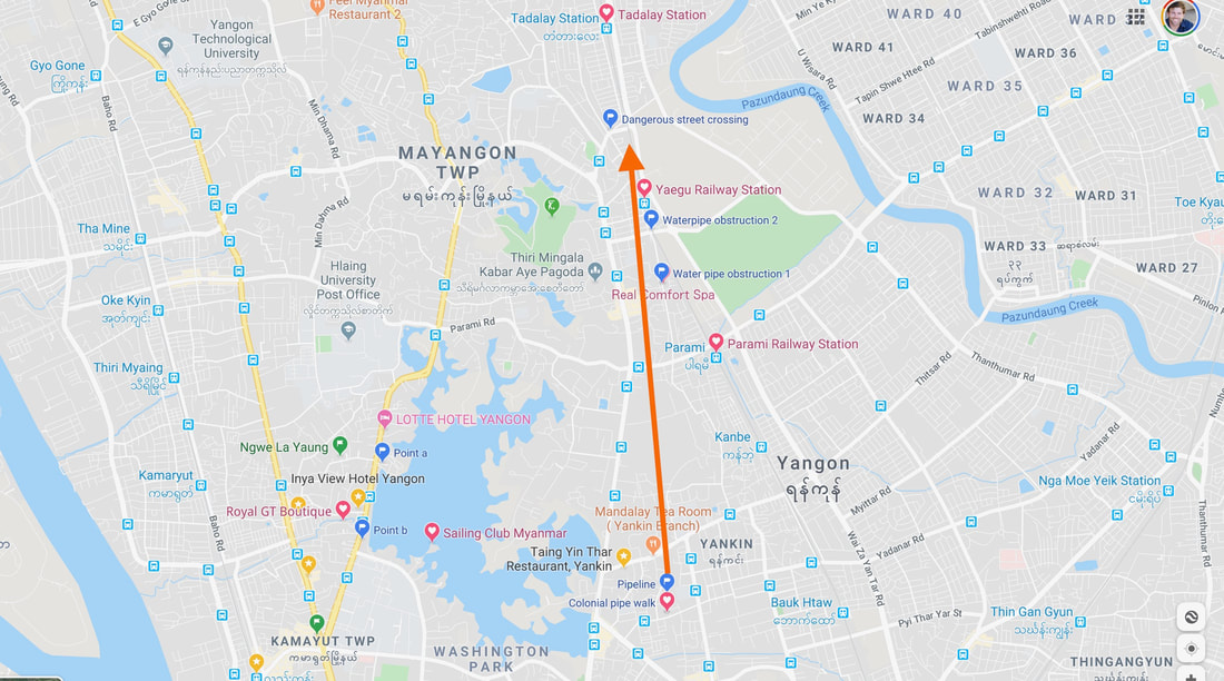 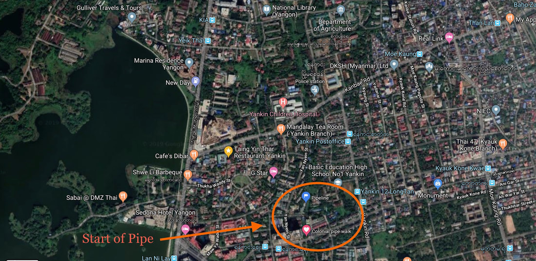 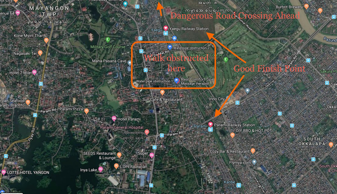 Enjoy this unique adventure away from the tourist hotspots and the cacophony of the city streets.
 I too am not a bit tamed, I too am untranslatable,
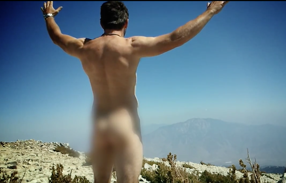
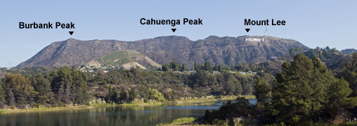
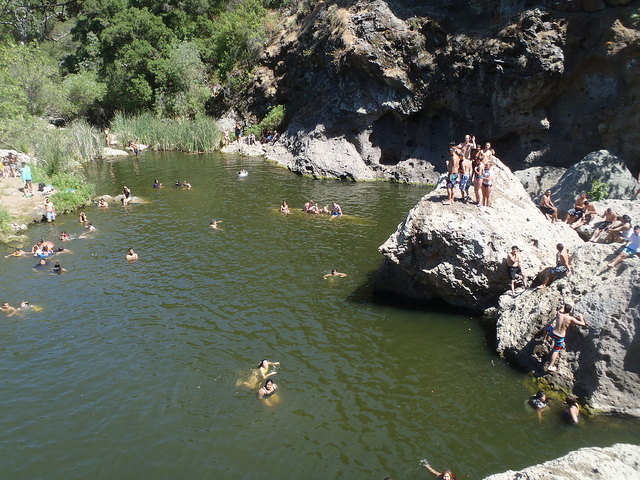
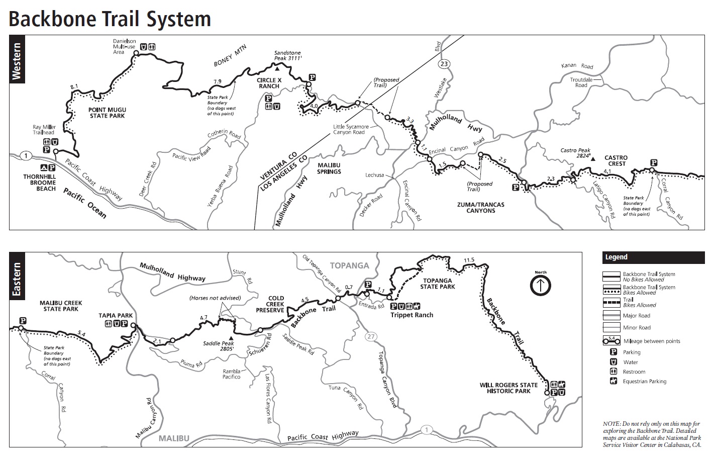
I sound my barbaric yawp over the roofs of the world. - Walt Whitman** If you've ever climbed to a mountain summit you know the jubilation of the accomplishment. We lift up our arms, high- five our companions, and take pictures. Then the elation quickly fades as thoughts of descent and food replace it. But what if we could savor that moment a little longer? Enter the barbaric yawp. The mountaintop is a special place for release. Not something refined for your friends' ears. Not some cliched sound effect. Not something muted for fear of disturbing the neighbors. Rather give a vocalization to your "I am that I am." The sound of your life-force. The announcement that at this moment in time you are truly alive. Take off your clothes if you dare. Sense the warmth of the sun and cool of the wind on your skin. Feel the grit of earth under the feet. Recognize that you are a product of this natural world. You are a ripple in the fabric of the cosmos. Observe everything around you with the gift of awareness. What a mysterious thing it is to be conscious. Notice the beauty of existence exactly how it is. Then spread your arms high and sound your barbaric yawp so it can see you right back. ---- If you'd like to see my barbaric yawp in action be warned that you'll see me naked from behind (i.e. bare-assed): Naked B.Y. ** The first time I heard this poetic stanza was as it was referenced by Robin Williams in Dead Poet's Society. It's easy for the unfamiliar to erroneously assume LA is one big concrete jungle. The truth is outdoor adventure is more accessible than in most cities. Within 15 minutes you could get from Santa Monica to the Temescal Canyon Loop trailhead, from Hollywood to Runyon Canyon, or from Silverlake to Griffith Park. These are, however, rather popular trails on any given day. The main Runyon loop is in fact about 80% trail and 20% catwalk. If you want to try a little something different give these tracks a gander. Some of these routes take a higher level of agility, conditioning, and balance. Know your limits: 1. Coral Canyon - Jim Morrison's Cave 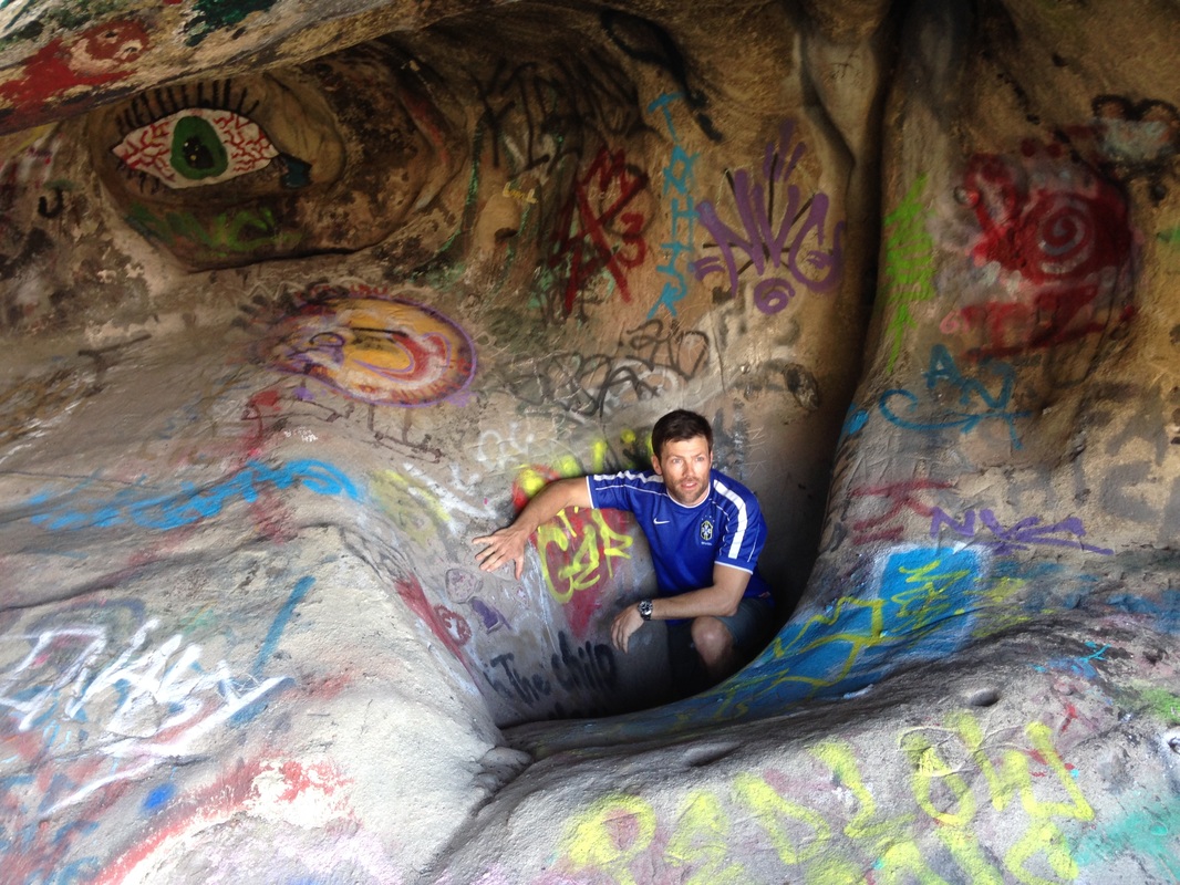 Park at the top of Corral Canyon Road / Castro Peak Motorway and cut SE along a section of the backbone trail. Just before you get to a large rock spiral you'll notice a plain looking hump of rock off the trail to the left. On the side is the secret "birth canal" opening. Slither through and you are in the cave of Morrison's LSD inspired reveries. How you choose to honor the occasion is a whole other adventure. GPS: 34.080502, -118.749228 Update 6/29/16: There is now a sign saying the cave is officially closed. The sign ironically will guide more people to the spot which was otherwise hard to find. It's also far enough from the entrance for someone to reasonably claim that they approached from a different angle (and didn't see the warning) or thought it was referring to something else (as the whole area is riddled with tiny caves). I definitely did not see it until I already came out! 2. Tree of Life (AKA Wisdom Tree)  The famous Hollywood sign is on a bit of a mesa. As you trace your eyes to the left you'll be looking at Mt Lee, Cahuenga Peak, and finally Burbank Peak just before it plunges down to the pass occupied by the 101 highway. On the corner of that mesa is a lone tree of mysterious origin which is the only survivor of a grove that burned up in a 2007 fire. This solitary stone pine is now honored by hikers as a place of reflection and reverence both due to the view and the indominatable life-spirit of the surviving pinus pinea. Hoodoos have been erected around the tree and an ammo box is full of musings to which you can add. There is a steep path straight up to the tree, but I came at it from Griffith Observatory, walking over the ridge-line from Mt. Hollywood, past the backside of the Hollywood sign, and finally to the tree. 3. Nazi Camp (Murphy's Ranch) 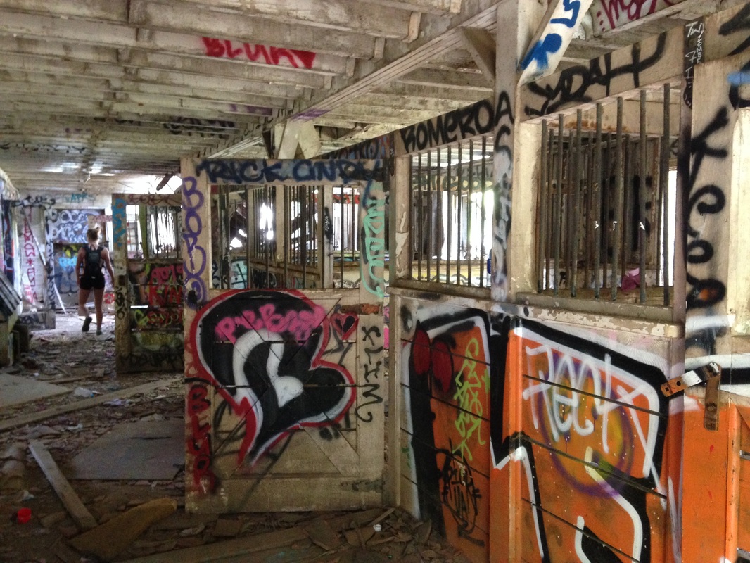 Wedged in a forested grove near Will Rogers State Historic Park are the scattered remains of a compound with an intriguing backstory which may bring to mind The Man in the High Castle. Although it's a fairly easy hike, this is a fascinating jaunt around a unique piece of history with unsolved mysteries entwined through it. Many hikers seem to stop short of the whole scene so take your time to poke around. Don't miss the abandoned barn (pictured) in the back. Update 6/29/16: I've heard the authorities have recently been patrolling the area more. If you slip inside anything with a gate on it you are assuming a bit of risk. There are also plans to tear some stuff down, so time may be limited to see it all. Any info on this please post in comments. 4. Mt. Hollywood Summit at Night 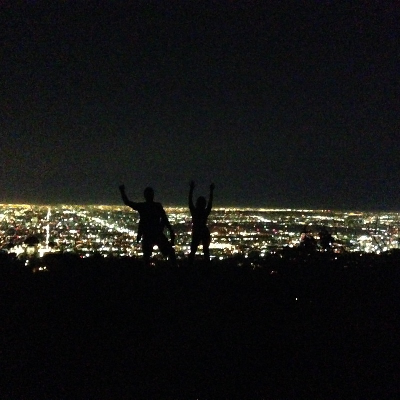 Heaps of people climb Mt. Hollywood, looming above the Griffith Observatory, and several Meetup groups do it at night. However, nobody does it late at night. When all of the city is at drinking at a bar or Netflix & chilling you can make this easy climb up the mountain with only the coyotes to keep you company. The stunning matrix-like grid of Los Angeles stretches out through the dark revealing the scope of this mega metropolis. There is so much ambient light from the city that you can do without a flashlight even on a new moon, although i'd recommend bringing a headlamp. On anything close to a full moon a flashlight is completely unnecessary... the whole mountain practically glows. From the top you'll get 360 views to the coast, the valley, the city, and the Inland Empire. Access off Los Feliz by the bear statue. 5. Malibu Creek State Park - Rock Pool to Lake  Wedged in between steep cliff faces in Malibu Creek Park is the fairly popular "rock pool". Because of easy access this spot is rather swamped with casual hikers on any given weekend who unfortunately don't embrace the "pack it in - pack it out" ethos. Thankfully most of this crowd doesn't have the knowledge that my favorite scramble in greater Los Angeles begins right behind them. Make your way behind the pool by either swimming (a dry bag would be useful) or by bouldering along the rock face on the far side, then continue upstream until you get to a dam. Ascend up the left side of the dam and you're at a serene little lake with floating lily pads. Along the way you'll pass through massive boulders that have fallen into the narrow canyon over the ages, which you can climb over or sometimes under. The rocks have created a few isolated swimming holes along the way. Look closely through the clear water and you'll see giant crayfish. From the lake hike up the hill to your right and connect with a return trail for your exit. 6. Parker Mesa via the Secret Loop Path 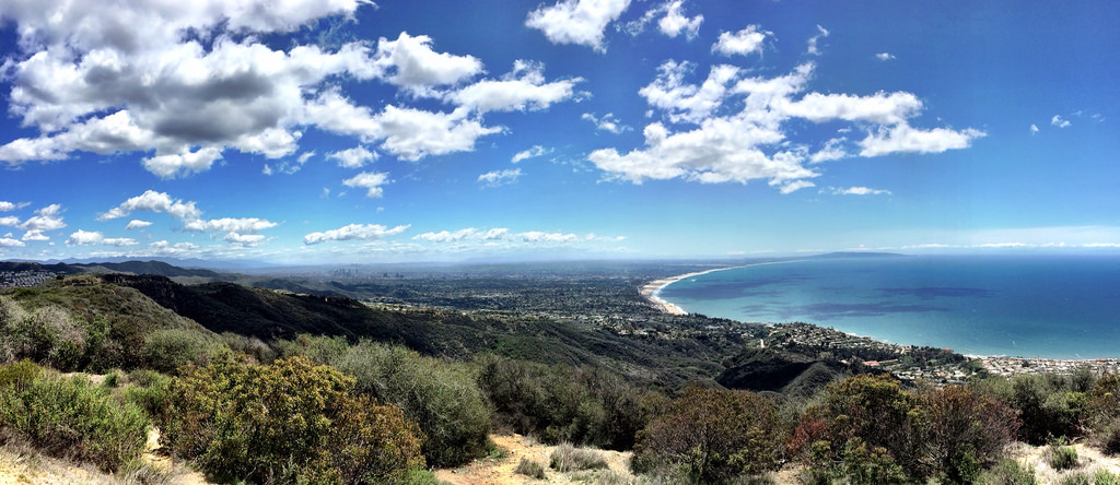 Parker Mesa (via Los Liones or Paseo Miramar) is a popular westside route, and for good reason. The sweeping views of the LA bay are worth the effort. But 95% of hikers do this as an out & back. I loathe returning the same way I came so I always sniff out the loops, and I found one here. As soon as you enter the new gateway at the Los Liones entrance you'll notice a concrete drainage to your left. Drop down and up the other side. The trail will now be evident. It cuts level alongside the western spine for a 100 meters or so and then shoots steeply up through some trees to get you atop that ridge. Now just follow the ridge all the way up until emerging directly below the park bench atop the famous Parker Mesa viewpoint. It's a strenuous climb, but you'll make it to the top in about 1/3 the time of the typical direction. Keep an eye out for the Getty Villa emerging directly below you. I like to schedule my hike up to grab sunset at the summit. The descent (along the normal route) can be easily negotiated at night as it's a fairly wide fire road. Just be cognizant of your turnoff onto the single-track near the end that takes you back to Los Liones. If you pop out on the street at Parker Mesa you'll have to backtrack about 5-10 minutes to find the narrower path going down. 7. The Backbone Trail 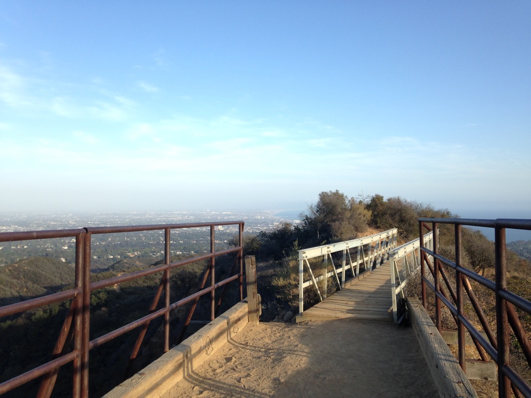 The big kahuna of LA hikes that few dare stretches over 60 miles of the Santa Monica Mountains from Will Rogers State Historic Park to Thornhill Broome Beach in Ventura County. I've only done the first segment, which is logistically the easiest: Park near Will Rogers, hike to the town of Topanga, and Uber/Lyft back to your car. The rest of this behemoth is more challenging due to its lack of convenient break points and dearth of water sources; however I plan to tackle it in the next couple months. Keep an eye out for the detailed blog post.
Update 6/1/16: The few missing sections of the trail have been acquired. All 67 miles await you. Update 6/29/16: I've since done a few more chunks of the Backbone using a two car system as Uber/Lyft is not a reliable option and I didn't want to hike back. The trail actually passes right by the Morrison Cave (my first suggestion on this list), which has changed a touch since I was there last. |
 RSS Feed