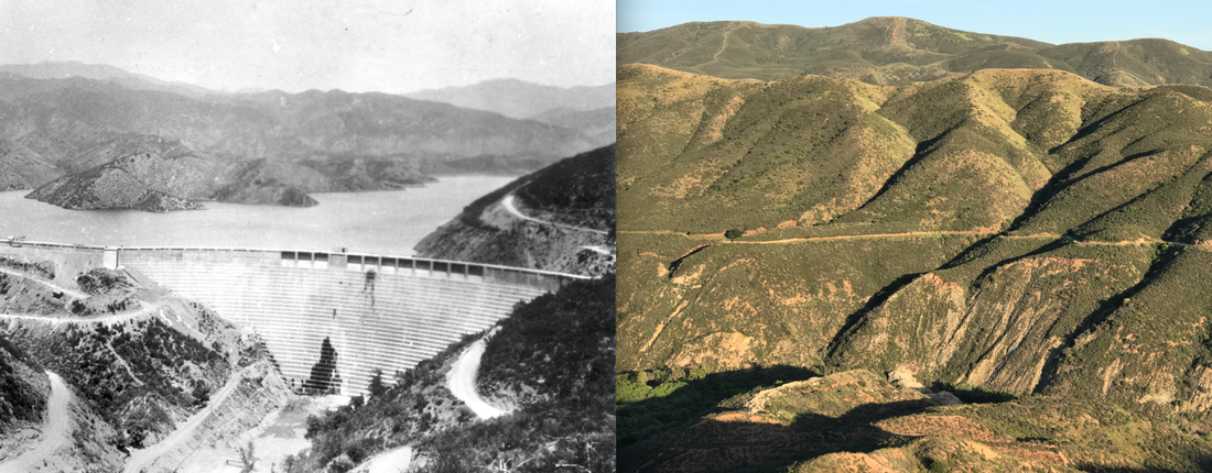
St. Francis Dam 1927 and its remains 93 years later
One night 500 Californians were killed and thrown into the ocean. There were smashed and drowned by a fifty meter wall of water as it tumbled violently down a series of valleys. Bodies were recovered as far south as Mexico. The catastrophic collapse of the St. Francis Dam was the second biggest tragedy in state history, and the epic downfall of California's favorite son: William Mulholland. Despite the dramatic story and stunning setting this spot is rarely visited. Southern California's grand disaster has become a traveler's secret spot. Here are my recommendations if you'd like to discover it: 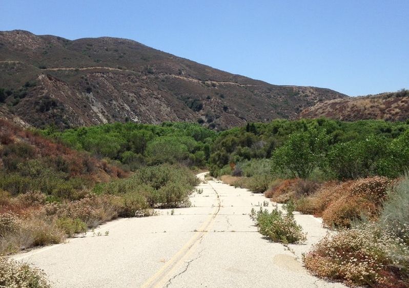
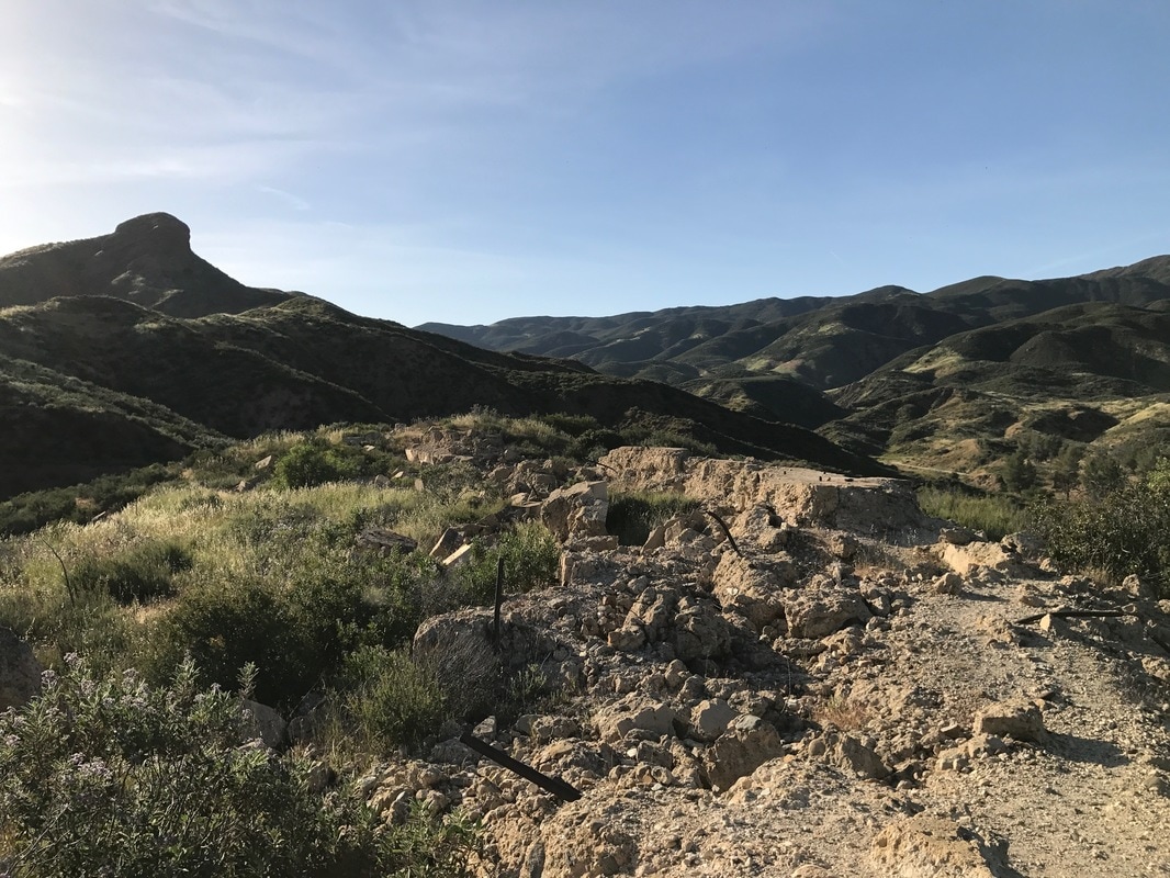
1. Hike Up the Abandoned Road: Take San Francisquito Canyon Road about a hundred meters north of San Francisquito Motorway. On the east side of the street you'll see this abandoned road barricaded off. Walk towards the lush forest growing where the old lake water pushed against the dam. Emerging from the forest there will be piles of rubble to your left and a small hill to your right. These are both worth exploring.
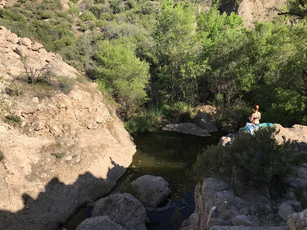
2. Scramble over the Rubble to the Left: Climbing over big chunks of the old dam notice metal pipes and other curiosities poking out of the ruins. Once you surmount the first pile you'll find a serene little creek and pool on the other side. It's a good spot for a tiny picnic. I took a dip on my first visit, but saw an unidentified snake slither off in the deep. There may also be more concrete with metal attachments underwater, so I'd advice against leaping in unless you thoroughly explore the depth.
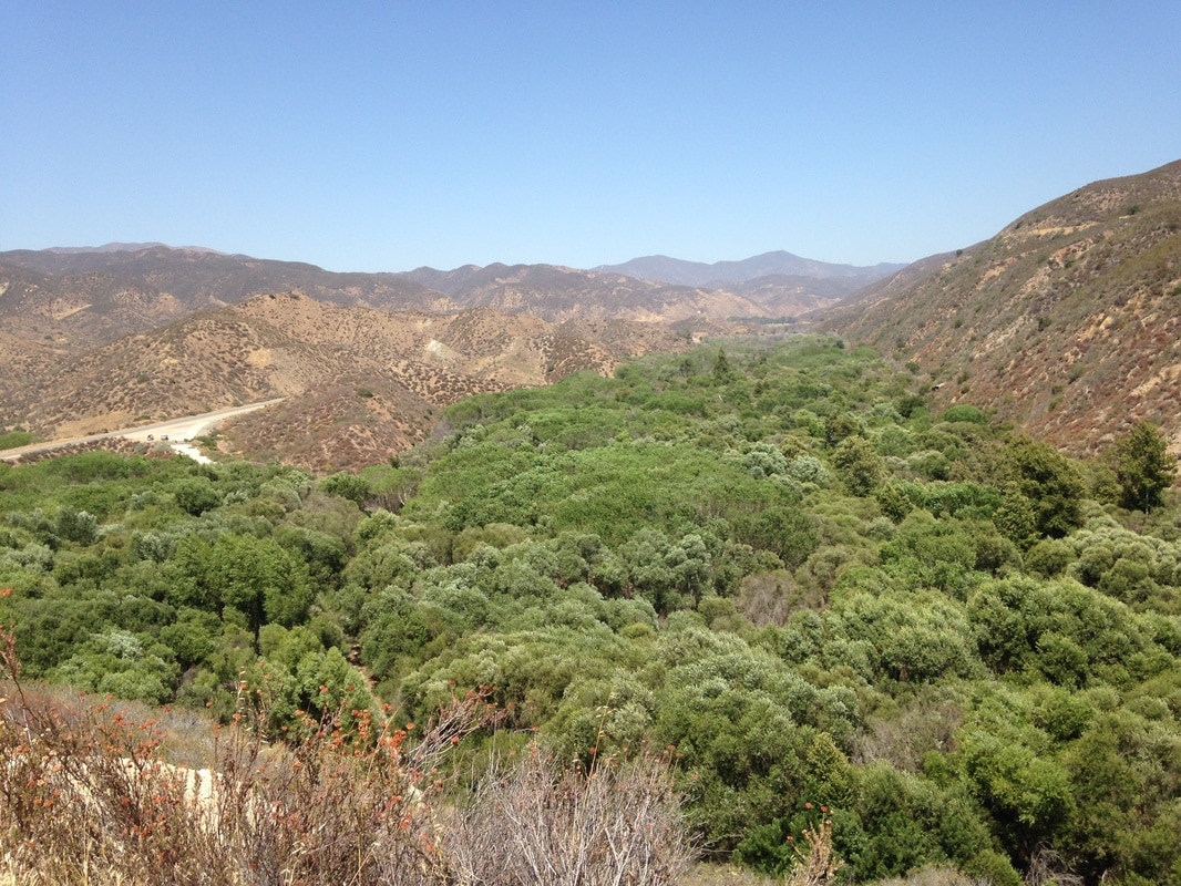
3. Climb up the Ridge to the Right: After scrambling around the rubble to the left of the road, go back and scale that ridge on the other side. It has very clear remains of the dike which was a 3 meter extension of the old dam. From the top it's easy to see the exact placement of the doomed structure. Also, looking north, you get this gorgeous view of the forest, dramatically lush in contrast to the dry hills around. Notice your parked car off in the distance by the new road.
4. Head for the Big Rock in the Distance: From the ridge, looking across the rubble of the old dam, a prominent rock is visible. To get there drive down San Francisquito Motorway about 1.3 miles until a fireroad appears on the left. From there it's a fairly easy climb up to a T junction. Go left on the narrower trail which will lead straight to that rock. From the top one can see the remains of the entire old dam and trace the path of the water as it plowed down the valley before hooking a right around Castaic Junction, following the Santa Clara River Valley to the Pacific Ocean.
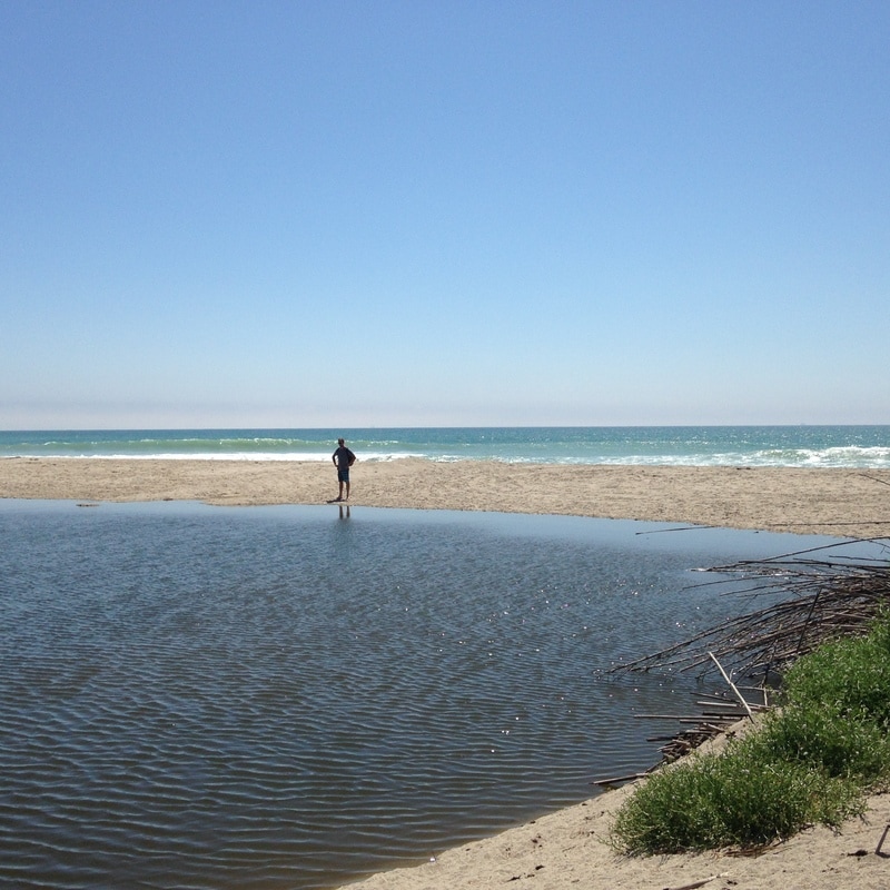
5. Extend your Exploration: To make a full day of the St. Francis Dam story, follow the water course down towards Ventura.
Before going, read the dramatic story of the St. Francis Dam and the rise and fall of Mulholland. It's a doozy of a tale which will make this adventure all the more impactful.
3 Comments
5/25/2017 10:35:50 am
This was an interesting overview. I hope to see some more explanations on the point. 5/27/2017 03:45:55 am
We have to go a long way to get to these hilly places. However, the staying here will broaden the horizons of our view of this area. 2/12/2018 02:12:28 am
Beautiful sights. So many wild nature. I love walking in the places like this. Such a scene helps me to think better. I love walking there alone, when I need to make an important decision. It always helps. And I really loved your program of discovering the place. They are really interesting Leave a Reply. |
 RSS Feed